
AUSTRIAN CITY OF PONDS
Gmünd, Lower Austria

The International President of The Maria Nobrega Foundation and ITKI, Mrs. Elizabeth Nobrega Tsakiroglou, together with the International Chairman of The Maria Nobrega Foundation and the Founder of ITKI Austria, HRH Andreas Salvator Habsburg Lothringen launched 'Gmünd the Austrian City of Ponds' project in early 2020.
The history of Gmünd has a certain importance linked to the evolution of 'the power'.
First, the representation of the owner of the land/country was secured by a castle. Mostly families of nobility. Later in situ tax sources were activated. Everywhere were rivers affluents had low water crossing. So 'the power' built bridges and financed cities with walls to create fortified cities. In such a protected space craftsmen could store their goods and trade could flourish. As populations grew food supply was necessary. The high lands were little productive because a very thin soil layer on clay substrate was suitable for holding water. Pond builders were brought in. The vegetation was burned in flat orographic depression. Man-made cultural landscape was introduced.
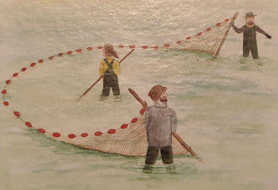
We can look on a 700 year history of pond construction and carp cultivation. A pond represents a reflection of run offs and a magnificent symbiosis between nature and man. This knowledge is preserved until now and ITKI Austria would like to distinguish the knowledge barer and net fishers with a distinction.
It is the knowledge of man, the wooden bottom closure, the estate of the water and its temperature, the daylight, the quiet reaction of the interaction of element exchange of chemistry facilitating the production of the natural food chain on land, in water and climate.
Water once liquid again it shrinks in volume into solid but from this temperature on, it expands again and fish can survive at the temperature of 4 degrees Celsius. Gmünd has a lot of genuine solution by gravity to the unique situation on watersheds.

'Watershed & Ecohydrology'
ITKI Austria
Symposium in Gmünd, Austria
15th, 16th & 17th of October 2021
As water cannot be created, it is finite; we have to learn how to use it wiser.
"We call ourselves, who live in the Wildviertel: 'up here', near the Czech border. Only some 980 ㎢ of Austria runs to the North and divides the Wildviertel by the water division line in two parts : one who runs to the Black Sea’ and the other one who runs through the Elba, to the North Sea", HIRH Andreas-Salvator Habsburg-Lothringen, The International Chairman of The Maria Nobrega Foundation and Founder of ITKI Austria.
One of the most remarkable features of our region, the so called 'Waldviertel', once the highest mountain on earth was located here. Erosion flattened the mountains, rivers changed their flow and vegetation adapted in order to harvest the rain. Every year the same amount of water evaporates but not every year the same amount of rain is given back to the land. Evaporation, condensation and circulation, nature does not work for free and it is our duty to make use of what the nature gives us. In this part of the world deep wells are rare, therefore since approx. the year 1250, our ancestors started to retain what the water brought. They stored it in some 1,800 ponds and at the same time a successful symbiosis between nature and man emerged from it. We try to store as much precipitation as possible in our man made ponds, we treasure like this landscapes and we like to share its beauty with you. Our pounds seemed like 'emeralds' in an overwhelming scenery. Austria sends its waters to several water catchments : Danube, Adria, Po River, as well as Rheine and Elba and therefore can be called as one of the roofs of Europe.
Although our region, Waldviertel, does not reach the impressive heights of the Alps, we are the highest horizon of our area. A twisted line is separating creeks and rivers, representing the ‘European Divisor Line’. Locally it's often represented by stones in the middle of the open terrain or forest.
In our area ‘harvesting rain’ is done by the endangered forest and often the wind decides in which water catchment basis precipitation falls.
Ecohydrology is the process of promoting the coordinated development and management of water, land and resources, in order to maximise the resultant economic and social welfare in an equitable manner without compromising the sustainability of vital ecosystems. (Audey Azoullay, UNESCO)
In the area around the small city of Gmünd, rivers are carrying an average of 4㎥ water per second to the North Sea, while other parts of the Waldviertel drain to the Black Sea, considering our special Geographic and hydrologic situation being an important wealth to the world’s seas. We take great responsibility for the quality of our water, which we send downstream.
In our symposium we will present you double cropping the fertility of the water and separating the precipitation in accordance were it falls on.
Problems like water contamination, sealed surfaces, and detrimental chloric contamination will address by our experts.
In a 'five pieces of the puzzle’ we will show you how we manage our waters, how we preserve the environment and the surroundings of the ancient town of Gmünd.
Please see video below.
